Exploring the Depths of Black Canyon of the Gunnison: A Two-Day Itinerary Through America’s Most Underrated National Park
Article Editorial Team
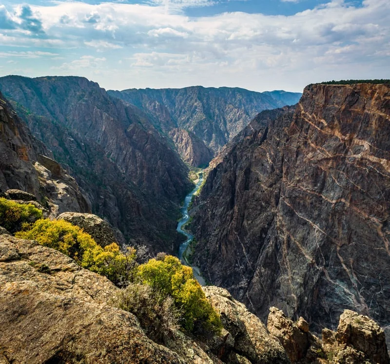
Nestled in the rugged landscape of Colorado, Black Canyon of the Gunnison National Park remains one of the least-visited and most under-appreciated national parks in the United States. The defining characteristic of the canyon is its striking geography: it is so narrow and exceptionally tall that the sheer rock faces are almost constantly cast in shadow, causing the dark stone to appear virtually black from top to bottom.
Despite the dramatic scale of its vertical drops, the park itself is relatively small in acreage compared to its western counterparts. This compact footprint offers a distinct advantage for travelers, allowing visitors to experience all of the primary highlights, scenic vistas, and key trails in just one or two days. Because the canyon is sharply split between two distinct sides by the roaring Gunnison River with no bridges connecting them, traversing from one rim to the other requires a drive of over two hours. Consequently, travel authorities and park rangers recommend dedicating separate days to each rim to fully appreciate the unique perspectives each side provides.
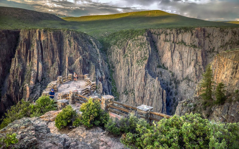
For travelers operating on a tight schedule with only a single day to spare, the South Rim serves as the premier destination for viewing the park’s most iconic features. A comprehensive two-day itinerary, however, allows adventurers to transition to the secluded North Rim on the second day, capturing the full breadth of what the canyon has to offer.
The South Rim Visitor Center and Initial Orientation
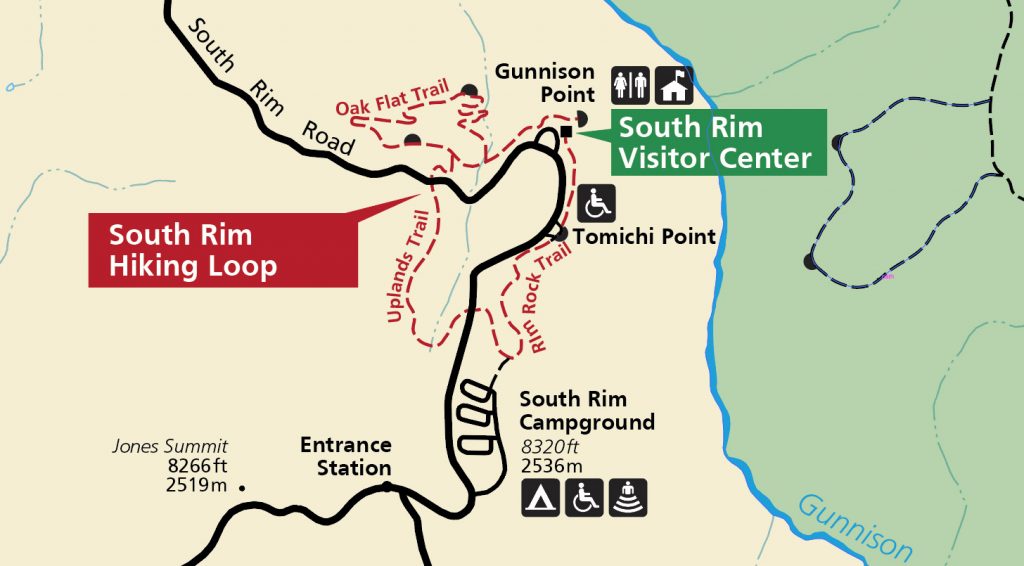
Upon entering the park from the south, the essential first stop for any visitor is the South Rim Visitor Center. Functioning as the primary hub for the area, this facility serves as the starting point for several prominent trails and sits within easy walking distance of two must-see scenic overlooks. Experienced travelers consistently recommend making the visitor center the very first destination to handle logistics, utilize the restroom facilities, acquire a hard copy of park maps, and consult with park rangers regarding any daily updates, trail closures, or crowd advisories.
Once oriented, visitors frequently kick off their exploration with a morning hike before taking advantage of the park’s vehicular roadways.

Hiking the Oak Flat Trail and South Rim Loops
Among the most breathtaking footpaths in the park is the Oak Flat Loop. Spanning just two miles, the trail immerses hikers in scenery that easily captivates attention well beyond the standard forty-minute completion time. For the optimal experience, hikers are advised to navigate the route in a counter-clockwise direction. While the beginning of the trail features a series of switchbacks, the remainder of the path levels out into an easy, wide, and well-maintained walk flanked by a diverse array of trees and exceptional framing of the canyon below.
For visitors seeking a more substantial physical challenge, the broader South Rim Hiking Loop combines three popular pathways—the Rim Rock Nature Trail, the Uplands Trail, and the Oak Flat Trail—into a cohesive four-mile trek that takes approximately two hours to complete. Once hikers have returned to their vehicles, the journey continues along the park’s primary scenic route.
South Rim Scenic Drive and Overlooks
The South Rim Road spans a modest seven miles, yet it packs an immense visual punch by guiding motorists past twelve distinct scenic overlooks, five hiking trails, and four inner canyon routes. Serving as a core highlight of the park, a non-stop drive along this corridor takes less than thirty minutes, though motorists routinely spend an entire day stopping to absorb the panoramic vistas.
Beginning the journey from the visitor center and heading northwest, the first recommended stop is the Pulpit Rock Overlook. Situated just one hundred feet from the roadway, this easily accessible vantage point offers sweeping views of the rushing Gunnison River and both opposing sides of the deep canyon.
Further along the route lies the Cross Fissures View, one of the more unique lookouts on the South Rim. Unlike many neighboring overlooks, the Gunnison River is entirely obscured from this perspective. Instead, the visual focus centers squarely on the remarkable, jagged rock formations and complex fissures that have carved themselves deep into the canyon’s stone walls over millennia. Requiring only a fifteen-minute walk from the road, the short excursion delivers striking geological details.
Another crown jewel of the South Rim is the Painted Wall. Easily visible from multiple points, the absolute best location to observe its intricate striations is the Painted Wall Overlook. The dramatic, lightly colored bands cutting across the dark rock give the illusion of having been deliberately painted onto the surface, the result of two distinct geological rock types fusing together during the canyon’s formation. Beyond its geological significance, the Painted Wall serves as a prominent nesting habitat for Peregrine Falcons, adding a layer of wildlife viewing interest for visitors.
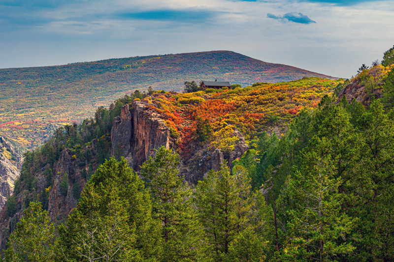
Just a short distance away, the Cedar Point Nature Trail requires only about ten minutes to complete while delivering some of the finest vantage points on the entire south side. The flat, wide, and dog-friendly path frames a picture-perfect composition capturing the Painted Wall, the distant Gunnison River, and both canyon rims in a single expansive shot.
The scenic drive culminates at High Point, which serves as the turnaround location for South Rim Road. Outfitted with a parking lot, restroom facilities, and a small picnic area, it provides an ideal setting to unpack lunch before beginning the return journey. High Point is also the trailhead for the Warner Point Nature Trail, which trades direct views of the deep canyon for a sweeping, bird’s-eye perspective of the nearby city of Montrose.
Venturing Down East Portal Road
Depending on the pace of travel, morning activities along the South Rim can occupy an entire day or transition into an afternoon break in Montrose, where a selection of local bars, restaurants, and hotels await travelers seeking to unwind. However, visitors eager for further exploration can embark on a descent down East Portal Road to reach the literal base of the canyon.

Accessible directly from the South Rim, East Portal Road drops five miles down into the canyon depths. Because the route features extreme grades reaching up to sixteen percent alongside tight, windy switchbacks, motorists must navigate the descent and subsequent climb with extreme caution. The round-trip journey typically takes between two and three hours of careful driving, but the effort rewards travelers with an entirely inverted perspective, allowing them to dip their toes in the chilly waters of the Gunnison River while looking straight up at the towering, shadowed canyon walls.
Day Two: Discovering the North Rim
The second day of exploration shifts focus to the North Rim of the Black Canyon. Known for being significantly quieter and more secluded than the bustling South Rim, the northern sector offers a rugged, intimate wilderness experience. Travelers departing from accommodations in Montrose must factor in a drive of roughly two hours to reach the North Rim Ranger Station. Because there is no traditional visitor center on this side of the park, visitors must ensure they bring maps and adequate supplies before venturing into the backcountry.
The northern itinerary opens with a stop at the Chasm View Overlook. A short, looped trail brings visitors to breathtaking vantage points overlooking the Painted Wall and Serpent Point. Looking across the chasm from this angle, visitors can often spot tourists on the opposite South Rim gazing back across the void.
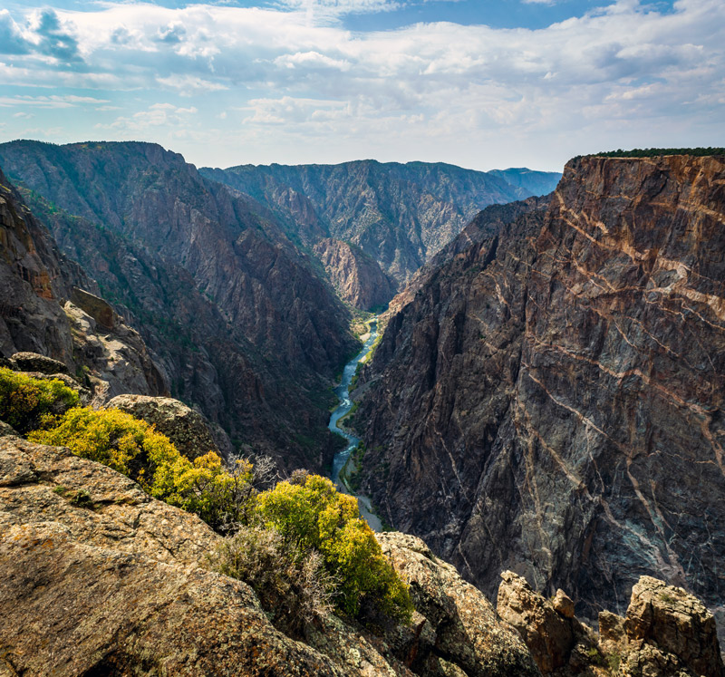
Following this initial stop, visitors frequently tackle the North Vista Trail, widely regarded as the longest and premier hiking route on the northern side. The initial 1.5 miles of the trail are relatively flat, meandering alongside the rim through a forest of pinyon pine and juniper. A short diversion leads hikers to Exclamation Point, where a direct, dramatic view reveals the Gunnison River far below, flanked on both sides by soaring canyon walls.
For those desiring an even greater challenge, the trail continues onward toward Green Mountain. Standing as the highest hike within the park, the path grows increasingly strenuous toward the summit. Hikers who complete the journey are rewarded with the most expansive panoramic views in the region, encompassing the distant San Juan Mountains, the West Elk Mountains, the Grand Mesa, and the Uncompahgre Plateau. The round-trip trek to Green Mountain consumes upwards of three hours, anchoring the morning’s activities before a much easier return trip.
After completing the hike, visitors often rest at the North Rim Campground, the only designated area on the north side equipped with picnic tables. Shaded by mature pinyon pines and junipers, the campground provides a tranquil environment to recover strength before embarking on the final stretch of the itinerary.

North Rim Scenic Drive
The conclusion of day two involves a leisurely drive along the unpaved North Rim Road. Spanning 4.5 miles, the route features five scenic overlooks that encourage a slow, deliberate pace. While motorists can visit every stop, time constraints often lead travelers to focus on three standout locations: The Narrows, Island Peaks, and Kneeling Camel.
The Narrows places motorists right alongside the road at the most compressed section of the Black Canyon, demonstrating that sweeping views of the Gunnison River do not always require strenuous hiking. Continuing to Island Peaks, the perspective shifts away from the river toward a striking landscape of jagged rock spires rising sharply toward the sky, offering a view straight across to the distant Gunnison Route on the South Rim.
The final stop along the route is the Kneeling Camel Overlook. Situated directly adjacent to the road, this viewpoint provides a final, arresting look at the steep canyon walls and the river far below. Following this stop, drivers turn around to retrace their route, concluding their journey by grabbing a bite to eat in the small nearby town of Crawford or returning to Montrose for the evening.
Related News